Hi everyone! This week let me tell you about a recent rove that began with one plan in mind, didn’t work out, morphed into a quite different plan midstream, and still turned out to be what I like to call a “Perfect Ham Radio Day.”
A few weeks ago, I hit the road as a rover for the Ohio State Parks On The Air (OSPOTA) Contest. This would be only the second time I’ve roved for OSPOTA.
OSPOTA had its beginnings in 2008 as a new activity for the then-fledgling Portage County Amateur Radio Service (PCARS). You can read more about OSPOTA on our website at ospota.org or in this recent OnAllBands article about the 19th Annual Ohio State Parks On The Air Contest.
I joined OSPOTA around 2013 as a board member to help with the tech side of things. What began as a simple website maintenance gig has grown to include log-checking. Personally, I’ve always enjoyed portable Field Day-type operating, and OSPOTA seemed to scratch that itch for me.
This year marked my 17th season participating in OSPOTA. I’ve operated from a number of parks over the years. For most of the past eight years, my go-to park has been Mount Gilead State Park in Morrow County. But this year, my plans to drag the camper over to Mount Gilead fell apart due to recovering from some surgeries. Plan B was to instead be a rover.
In case you’re wondering, a rover is a contest participant who lights up not one but several locations over the course of a contest. In the State QSO Parties, rovers will activate multiple counties. It’s the same in OSPOTA, but instead of counties, we light up Ohio state parks.
My plan was simple enough: begin at Quail Hollow Park, head north to Wingfoot Lake State Park, then northeast to West Branch State Park. After West Branch, I’d backtrack and hit them all again. On the return trip, I planned to break out the 80 meter antenna for more contacts. Unfortunately, that didn’t quite go as planned.
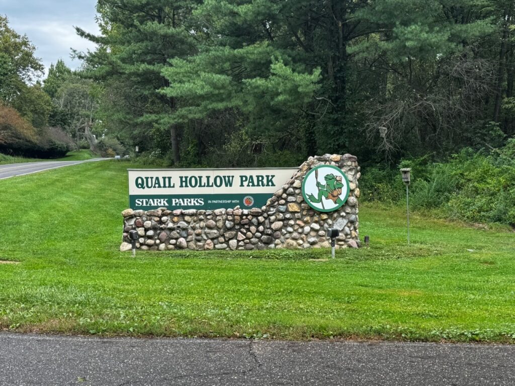
Quail Hollow was my first stop, and it has an interesting past of its own. Long before anyone showed up with a radio and an antenna, the property was farmland. It later became the country estate of railroad executive Harry Bartlett Stewart. Fifty years ago the Stewart family sold more than 700 acres and the estate to the State of Ohio for about half its appraised value, creating Stark County’s first state park. In 2016, the state transferred management of the park to Stark Parks, the Stark County park system. It still counts, though, as a state park in the eyes of OSPOTA and other programs.
Quail Hollow is one of two parks that I consider my “Home Park.” When I get tired of radio, there are plenty of other things to do. I’ve hiked part of the Buckeye Trail that passes through Quail Hollow. There are also bike trails and horse trails that get quite a bit of use.


The weather this year was not bad when I was there, but the radar picture told me that it wouldn’t last. After setting up the station in the cab of the truck, I was about 30 minutes late for the start of the contest, so I got to work making up for lost time.
By the time I needed to move on to the next park, I had a good start on the log. Several contacts were in other Ohio state parks. Conditions were great on 40 meters, and I was optimistic about a good score. The next park would be Wingfoot Lake State Park in Suffield.
My earliest memories of Wingfoot Lake were from the time it was a company park for the Goodyear Tire & Rubber Co. I believe my family attended some reunions there during my childhood. My most vivid memory, though, was attending the Goodyear Hamfest there in the late 1970s. It was one of the best hamfests.
Goodyear’s connection with Wingfoot Lake goes back much further. The company purchased 720 acres there in 1916 for its growing airship operations. The lake was named for Goodyear’s familiar winged-foot logo, and a hangar, workshops, hydrogen plant, and landing field were constructed along its south shore. During World War I Goodyear even built blimps there for the U.S. Navy.
The north shore was later developed as a recreation area for Goodyear employees and their families. By the 1980s, more than 100,000 people were visiting the company park each year. Goodyear closed the park in 2006, and it became part of the Ohio state park system in 2009.


As I arrived at Wingfoot Lake, the rain was just beginning, and it didn’t improve during my brief visit. This doesn’t bother most rovers since we can usually operate from our cars. However, I didn’t feel like heading out in the rain to swap antennas. So, 40 and 20 meters were the order of the day at Wingfoot.
Before leaving the park, 21 stations wound up in my log. Modes were mixed between SSB and CW. I also worked several other Ohio state park stations. I would have loved to work more, but I needed to grab some lunch and head to my next stop: West Branch State Park.
West Branch Reservoir was created by damming the West Branch of the Mahoning River, and the state park opened in 1966. Beneath the waters of the reservoir lies part of the landscape that once surrounded the small community of Campbellsport, along with old roads, farms, and the original course of the West Branch of the Mahoning River.

The rain had let up by the time I got to West Branch, but a couple of brief listens to 80 meters told me that it wasn’t going to be the money band I’d hoped for. Depending on conditions, 40 meters can either run long or short. If it runs long, then 80 meters is where all the park-to-park contacts happen, with 40 and 20 meters good for contacts farther out.
But when 40 runs short as it did that day, it’s great for working other Ohio state parks. The band was also quite active with stations participating in the New Jersey QSO Party (NJQP). The Colorado QSO Party (COQP) was also running that weekend, but those stations were mostly heard on 20 meters. Several of the NJQP and COQP stations got in the logs. Since their contest exchanges are similar to ours, they lend themselves to this style of operating.
With 80 meters apparently out of the picture, there wasn’t much reason to backtrack through the same three parks. It was time to make another plan. Instead of turning around, I pointed the truck toward Lake Milton State Park and decided to keep going.
Once arriving at Lake Milton State Park (US-3515), I chose a new operating location on Route 18, not too far from the town of Lake Milton. Route 18 was once the main road between Akron and Youngstown. Passing through the town on the way to the state park spoke to better days before the interstate came through. There are lots of small businesses and older buildings from back in the day.
There are plenty of small parking lots on the causeway approaching Lake Milton. I found a very relaxing spot where I could activate the park and enjoy the view. After setting up the rig, it was now mid-afternoon and the number of Ohio state park stations had declined a bit. So, it was time to head to 40 meters and get to work!


For an OSPOTA rover, the magic numbers are ten and four. That is, for an activation to be valid at any park, the activator must make at least ten contacts, including no fewer than four different Ohio state parks, not including the park the activator is operating from. That’s why my first priority at each park was to get four other parks in the log. After that, it’s time to have some fun! In my case, that fun lasted about 20 minutes—about the time it took to get 14 contacts in the log.
The next stop was to be Guilford Lake State Park in Columbiana County. Guilford Lake has an interesting history of its own. The lake was originally built in the 1830s as a feeder reservoir for the ill-fated Sandy & Beaver Canal. When the canal era ended, farmers breached the dam, drained the lake, and farmed the fertile lakebed. The dam was eventually rebuilt, the lake returned, and Guilford Lake became part of Ohio’s state park system in 1949.
Ironically, when I arrived for OSPOTA, much of the lake was gone again. The water has been drawn down for a major rehabilitation of the aging dam, including replacement of the spillway and improvements to the embankment and drainage system. Work is expected to be completed around the end of 2026, with the lake beginning to refill in the spring of 2027.

This was the final stop in my OSPOTA journey this year. I already knew of at least one group that was going to be activating the park as well. This was my home club, the Alliance Amateur Radio Club, which was running W8LKY for the day. So I made sure to stop by for some cold pizza.
While I was there, the conversation turned to Briar Island, located just offshore from their operating location. With the lake drawn down, someone came up with the idea of walking out and activating the island for the US Islands On The Air program. One of the guys had already tried it but quickly discovered that a drained lake doesn’t necessarily mean a dry lake. The exposed lakebed was still pretty gooey, and he wisely abandoned the attempt.
Briar Island would have to wait for another day, so I headed up the shore to finish out my rove. Conditions were beginning to wind down for the afternoon. Some stations in other Ohio state parks seemed to have packed up early. Since it was almost dinnertime, I admit to wanting to head for home as well. So once my minimum contacts were made, I packed up and left. I guess the pizza didn’t do much to quiet my hunger pangs.
It had been a great day with 96 miles driven and about 2.25 hours behind the wheel. I made 113 contacts and put 25 Ohio state parks in the log.

That’s it for this month. It was, as I said, a Perfect Ham Radio Day! How about you? What is your Perfect Ham Radio Day? Get out there and find out!
73 DE WG8X
The post The Perfect Ham Radio Day—Roving Five Ohio State Parks appeared first on OnAllBands.
OnAllBands